Features of the Ural Mountains
The Ural Mountains stretch from north to south for more than two thousand kilometers.
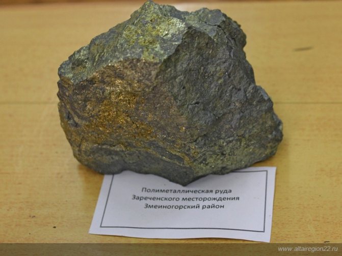
Formed at the junction of two tectonic plates - Russian and West Siberian, the Ural subsoil turned out to be a rich natural storehouse. Geographically, the Urals are divided into Polar, Subpolar, Northern, Middle, Southern. Mining in the Urals began several centuries ago. In the 20th century, 48 of the 55 most necessary minerals were developed in the Urals. The northern latitudes of the Urals are little developed due to their inaccessibility and climatic conditions. The Middle Urals are more studied, developed and populated. Our region is rich in ores of ferrous and non-ferrous metals, precious and rare minerals. The natural diversity of the Urals is explained by the origin of the area. The activity of the ancient volcano and the sea (during the Paleozoic period) became the source of the wealth of basalts, diabases, porphyrites, dolerites, liparites and other minerals of the region at the present time. The Urals is also of archaeological value - ancient metallurgists and imprints of various creatures on the mined stones.
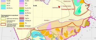
The natural resources of the Urals are rich and varied. About a thousand different types of mineral raw materials and more than 12,000 mineral basins have been found in the region. Almost all elements of the periodic table were found in the Urals. The region is also rich in non-metallic natural resources - oil, gas, salt, limestone, coal, oil shale.
Metallic and non-metallic ores, precious and rare chemical minerals formed due to metamorphic and magmatic changes are mined in the Urals:
- Iron;
- Chrome;
- Copper;
- Nickel;
- Aluminum;
- Asbestos ores;
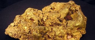
- Precious metals;
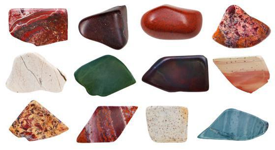
- Ornamental stones.
Ores of the Urals often contain many components. Due to this, the extraction of natural Ural resources is very profitable.
Combustible minerals of the Urals
Oil and gas fields of the Timan-Pechora oil and gas province and the Volga-Ural oil and gas province, incl. gas condensate Orenburg field, located on the western slope and in the Urals, concentrating mainly in the Pechora, Perm-Bashkir and Tatar arches. Oil and gas potential is established in a wide stratigraphic range - from the Riphean to the Triassic inclusive, industrial accumulations are concentrated in the Eifelian-Triassic structural stage and are confined to several regional gas and oil bearing, mainly carbonate, less often terrigenous strata of Devonian, Carboniferous and Permian age. Hard and brown coals are widespread. Industrial coal content is associated with the Tournaisian-Early Visean (Kizelovsky coal basin, Egorshino-Kamensky, Poltavo-Bredinsky coal-bearing areas), Permian (Pechora coal basin), Upper Triassic-Lower Jurassic (Chelyabinsk brown coal basin, Serovsky, Bulanash-Elkinsky coal-bearing areas), Upper Jurassic and Lower Cretaceous (Sosva-Salekhard brown coal basins) and with Paleogene - Neogene (South Ural coal basin) deposits.
Minerals of the Urals (Combustible minerals)
Iron ores of the Urals
The Ural ridge is famous for its rich deposits of magnetic iron ore. Magnetite is necessary for the production of cast iron, steel, and various metal alloys. Red iron ore, hematite and iron mica are also mined in the Urals (Bogoslovsky mine). Nickel ores and alumina (a source of aluminum and silica) are also mined in the area. Many samples contain chromium, nickel and cobalt. The Bakalskoye deposit is one of the largest in the development of these ores with an iron content of more than 40%.
In the Volkovskoe deposit, large amounts of copper, nickel, aluminum, phosphorus, and vanadium ores were found in the rocks. At the Krasnouralsk Copper Smelting Plant, copper and apatite concentrates are separated from them.
Deposits of the Sverdlovsk region
Considering the land wealth of the region, it is not surprising that geological and industrial tourism is thriving here. Moreover, both developed and active deposits are popular.
Mountain Karaulnaya
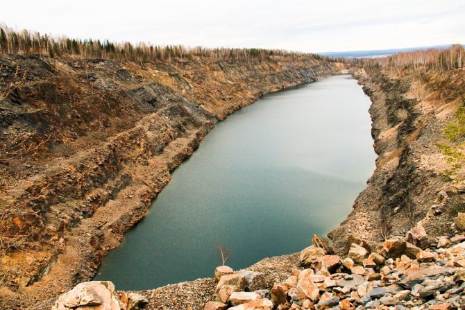
Karaulnaya is a mountain located on the outskirts of Pervouralsk . Previously, the mountain was used as a lookout point from which forest fires were monitored. Today the mountain is used for industrial purposes: the quartzite that the mountain is so rich in is used by a local factory to make fire bricks.
The most popular location on the mountain is Black Finger Rock , named because of the shape and color of the rock. Nearby there are also rocks in which you can find a small quartzite cave, the depth of which is about 10 meters. Some researchers suggest that this is the only mountain in the Urals consisting of quartzite.
Read more
Berezovsky Sands
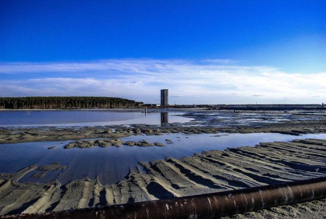
Berezovsky Sands is a tailings dump of the Berezovsky gold mine . Today the deposit is active, so it is worth visiting it on weekends. Although those who are not bothered by noisy BELAZ trucks and mine workers can come on weekdays.
The place is especially authentic during dry and hot periods – then it turns into a real desert. In strong winds you can even see a small sandstorm.
The Pudling Quarry has a slight resemblance to the Berezovsky Sands . It is located in the Sverdlovsk region near the village of Pudlingovy .
Read more
"Mariinsky mine"
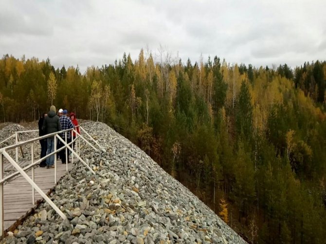
The Malyshevskoye emerald-beryllium deposit is the largest emerald deposit in Europe , one of three in the world and the only one in the Russian Federation .
The Mariinsky mine arose on the basis of an emerald-beryllium deposit discovered at the beginning of the 19th century. The main components of the deposit are emerald and beryllium oxide, with associated components being chrysoberyl, phenacite, alexandrite, phlogopite, lithium, rubidium, and cesium. Ural emeralds are highly valued on the world market for precious stones, as they are endowed with a unique yellowish tint, unusual for this mineral, and are known under the brand “Malyshevsky emeralds” .
In the spring of 2021, tourists began to be allowed into the mine on excursions, during which excursionists will not only be able to examine the precious stones and equipment of the miners, but will also be able to try themselves in this profession. In the same year, the largest emerald weighing 1.6 kilograms in 30 years was found the Malyshevskoye deposit
Read more
Cheremshansky quarries
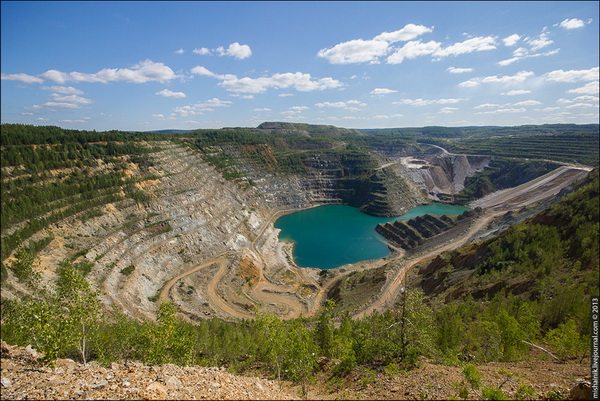
This deposit was discovered in 1907. However, full-fledged industrial development began only in the 1930s and 40s. Both nickel ore and snow-white marble were mined here. In the 1940s, there was a camp in Cheremshanka where Germans, Hungarians, Serbs and other foreign prisoners were held. The depth of the Starocheremshansky quarry reaches two and a half hundred meters. At the bottom of the now abandoned quarry, over time, a lake with clear and soft blue water formed.
Read more
Bogdanovichsky quarry
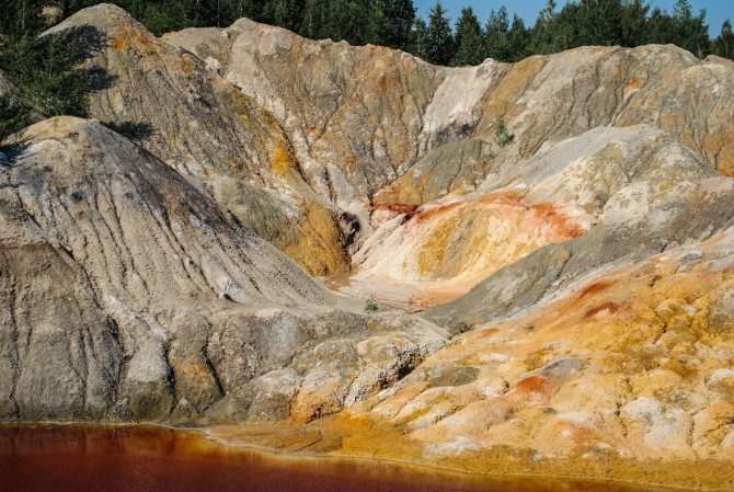
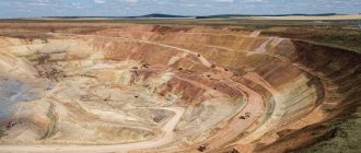
Popularly, thanks to its non-standard landscapes for the Urals , the Bogdanovichsky quarry of fireproof clays was called the Ural Mars . It occupies an area of about 70 square meters. km and is the largest in terms of reserves in the Middle Urals . Its resemblance to Mars is given by the shapes in which the clay hardens, as well as its color scheme. But it would not be so similar to another planet if man had not put his hand on it, filling the clay massif with various craters, depressions and hills.
Ordinary people may think: clay is not diamonds, why is it needed? However, this type of minerals is of quite high importance in various fields: from perfumery and art to construction and industry. Clay is especially valuable if it is fireproof, i.e. when processed by fire, it can withstand more than 1600 degrees. Such clay is most important in metallurgy, for example in the construction of blast furnaces.
Read more
Galkinsky quarry
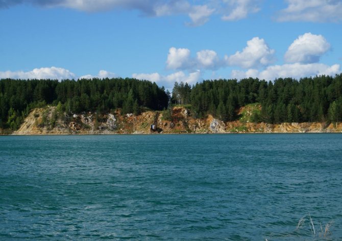
Limestone mining at this quarry began during World War II . During this period, the country had a hard time with transport - both vehicles and horses were taken to the front - transporting minerals became the most difficult undertaking. Galkinsky quarry , located near the railway tracks, was an ideal way out of this situation.
In the spring of 1942, the first tons of fluxing limestone were extracted from the quarry. Two operating quarries - Galkinsky and Veresovsky - supplied products to almost all metallurgical enterprises of the Urals: VIZ , Uralmash , Dinas , Pervouralsk Pipe , Serovsky , Izhevsky , as well as enterprises of the USSR - Votkinsk , Omsk and many others.
Today, the quarry is abandoned and, like most mothballed deposits, has turned into a lake - one of the favorite places for local divers.
Read more
Lipovsky quarry
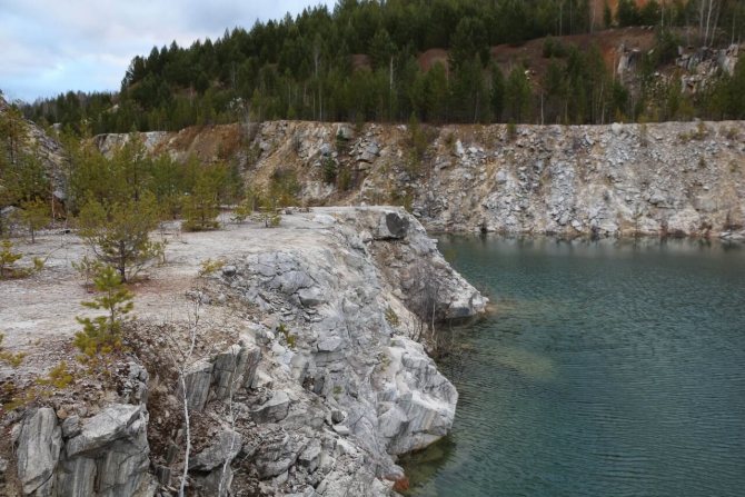
The abandoned Lipovsky nickel quarry in the vicinity of Rezha ( Sverdlovsk region ) attracts many curious people in the summer. It is remarkable both for its depth and for its rich and dramatic history.
The deepest reservoir in the Sverdlovsk region , the depth of which reaches a record 120 meters for the Middle Urals . The quarry water has an unusual turquoise hue.
Previously, expensive semiprecious stones – tourmalines – were mined here. The rich tourmaline mine was found completely by accident. It all started with the discovery of pink tourmaline crystals in an arable field. This happened in 1900. Since then, active development of the Lipovka semi-precious mines began. In addition to beautiful tourmalines, there were topazes, beryls, amethysts, aquamarines and other valuable minerals. Later, when a large nickel deposit was discovered here, the tourmaline mines were replaced by nickel quarries.
Currently, the quarry is abandoned and nothing is mined from it. After the cessation of mining, the quarry quickly filled with water from groundwater and atmospheric precipitation. The walls of abandoned quarries are gradually overgrown with young trees. Nature is restoring the harmony lost due to industrial developments.
It must be admitted that there are countless the Sverdlovsk region the village of Mindyak , Anatolsko-Shilovsky quarries , Staraya Lenza - there is not enough ink for the entire list.
Read more
Kamensky quarry
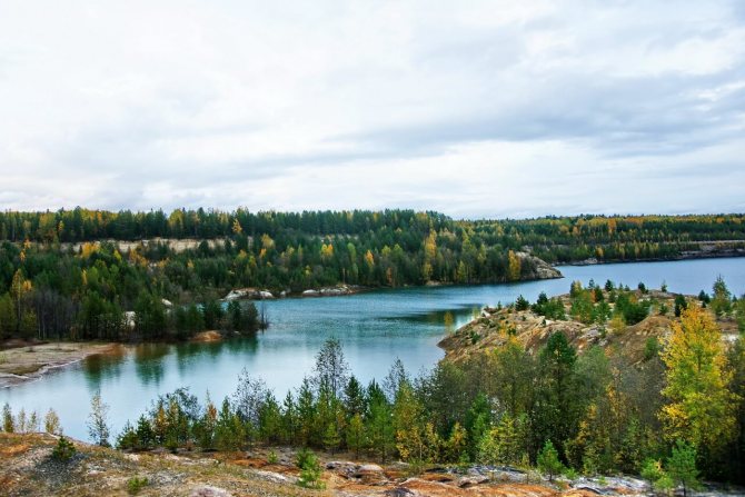
Or, as it is also called, the White Clay quarry . Until recently, active work was carried out here; clay was mined, which was highly valued for its fire-resistant qualities. Today it is a white-yellow desert with a beautiful reservoir, which is gradually becoming overgrown with forest again. The quarry is located near Krasnoturinsk .
Read more
Gems of the Urals
Ural gems brought great glory to the region. Precious stones and legends are known all over the world. Most types of gemstones are formed due to volcanic activity. Other types of stones (malachite, jasper, zircon, opal) are formed by layering hard rocks, as well as due to weathering of the surface.
The semi-precious stone amethyst is formed under the influence of pressure and high temperature in rocks containing manganese and iron. Amethyst mines are located in the Southern Urals. The Urals are rich in emeralds, topazes, diamonds, and rose quartz. These stones, mined in the Urals, are of high quality, which is especially appreciated by jewelers. However, natural reserves are not endless. The previously rich deposit of alexandrites was depleted, and the development was closed.
The Ural region is a real storehouse of various minerals, a unique natural monument of our country.
Non-ferrous metals of the Urals
Not only a large amount of ferrous metal is concentrated in the Urals, but also non-ferrous ores. They lie in mountain strata, and quarries and mines are used to develop them.
Copper
The Ural Mountains are very rich in copper mines. Enterprises located in this area occupy a leading position not only in Russia, but throughout the world. Several plants were built for direct processing of raw materials at the site of extraction of Ural minerals:
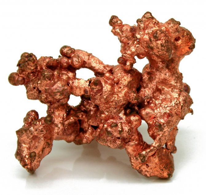
- Mednogorsky,
- Krasnouralsky,
- Sredneuralsky,
- Kirovogradsky
At copper enterprises, in the process of processing the resources of the Urals, other valuable metals are also formed: gold, cadmium, selenium, cadmium, platinum, zinc, lead, silver. Here blanks are cast from copper, which are then sent to factories for further processing.
Aluminum
A large amount of aluminum ore is also mined here; the area is rich in bauxite - minerals with a high content of this metal (up to 30%). The first deposit in the Urals was called Red Riding Hood, due to the specific color of the top of the mountain. Here the first metallurgical plant was formed for the production of aluminum ingots - billets. Now this site is being developed by the Bogoslovsky plant, and the mine has been renamed Severouralsky.
Northern Territories
The natural resources of the polar Urals are represented by minerals and iron ores. Corundum, turquoise, ferrimolybdite, clinozoisite, rhodochrosite, etc. were discovered here. The volumes of iron ores are estimated at millions of tons. There are deposits of manganese, bentonites, copper, chromium, and rare earth metals. The development of basins in the northern part of the Urals makes it possible to fill the shortage of raw materials in the region. In 2005-2006 studies were carried out during which predictive and promising basins were identified. Mining of manganese, iron, and chrome ore was planned. The predicted volume of the latter is more than 300 million tons. It is planned to increase the production of hard coal by 50% by 2021. This will help improve the energy situation in the state. In addition, in the northern territories it is planned to mine such minerals as gold, tungsten, phosphorites, lead, zinc, uranium, molybdenum, bauxite, tantalum, niobium, and platinum group metals.
Water reserves
The river network of the region belongs to the basins of the Caspian (Ural and Kama rivers) and Kara (Tobol river) seas. Its total length is more than 260 thousand km. About 70 thousand rivers flow through the region. In the river basin Kama included 53.4 thousand, rub. Tobol - 10.86 thousand. As for groundwater, its specific value in terms of units. area – 115 m/day/km2, per capita – 5 m/day/person. They are concentrated mainly in the mountainous regions of the Urals. They occupy more than 30% of the entire territory and include 39.1% of the total share of groundwater. The distribution of reserves is influenced by the dependence of runoff on structural, hydrogeological, and lithological factors. The Cis-Ural region is considered to be more endowed with water resources than the Trans-Ural region. This situation is determined by climatic conditions. Mountain ranges trap masses of moist air coming from the Atlantic. Accordingly, unfavorable conditions for the formation of underground runoff are formed in these areas.
Features of economic development
The Ural region is located between Siberia and Kazakhstan, on the border of the Asian and European parts of the country. This location has a very favorable effect on the economic development of the territory. The natural conditions and resources of the Urals make it possible to provide a connection between the eastern and western economic zones, which have different economic specializations. The region ranks second in Russia in terms of industrial production.
Relief
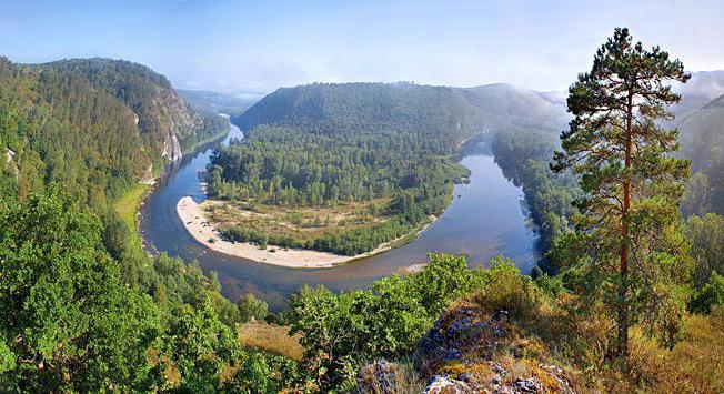
The Ural ridge extends along the 60th meridian. In the subpolar part, if you look at the map, it bends to the northeast. Closer to the south, somewhere in the Orenburg region, it turns southwest. Research shows that the modern Ural ridge was formed as a result of the uplift of the earth's crust more than 30 million years ago on the site of more ancient destroyed mountains. In this regard, it has a rather complex structure, consisting of rocks of different types and ages.
In the relief of the mountains, one can distinguish the main watershed ridge and many adjacent ridges, separated by extensive depressions.
In the north, rocky ridges, thin peaks, and glaciers formed. The foothills and piedmont plains are riddled with rivers. There are many lakes on the eastern side. The slopes of the peaks are covered with forests: in the north - coniferous, and in the middle part - mixed. In the middle part, at times there are almost plains, on which rise the remains of destroyed mountains - outcrops. In the south, the Ural Mountains rise again. Rivers flow here in deep gorges, forming many lakes.
Minerals of the Urals
Forest
It occupies about 30 million hectares (more than 40% of the territory). The share of coniferous forest is 14 million hectares. The main massifs are located in the northern part of the Urals. In the Perm region, forest covers about 68.9% of the territory. At the same time, in the Orenburg region. about 4.4% of tree plantations are present. The western slope of the ridge is covered mainly by spruce and fir, while the eastern slope is covered by pine trees. The total timber reserve is estimated at 4.1 billion tons. Species such as larch, fir, pine and spruce are of particular value. Forestry enterprises produce about 14% of commercial raw materials, 17% of lumber and about 16% of all paper in the country. Products are manufactured primarily for domestic needs. Enterprises are located in industrial areas.
Aluminum.
The aluminum industry of the Urals has its own raw materials. The Ural aluminum smelter was built near a bauxite deposit in the village of Kamensk (now Kamensk-Uralsky). The Bogoslovsky Aluminum Plant is the largest aluminum enterprise in the Urals, producing the first metal on May 9, 1945. The plant uses raw materials from the Severouralsk bauxite mine. These bauxites have high aluminum content and relatively few impurities. But aluminum cannot be obtained directly from ore; first, alumina is produced - a fine powder with a concentrated content of aluminum oxide, and only after that the metal is smelted from it at very high temperatures.
However, the problem is the deep occurrence of bauxite and the energy intensity of aluminum smelting in the Urals. Therefore, enterprises in the industry must simultaneously solve the raw material problem by using raw materials from other regions and developing other deposits, as well as strengthening the energy base.

