08/11/2020 Scientist cat Nature The economic life of each state depends on many factors. The country's own resources are also important. Mineral reserves are necessary in any industrial sector, agricultural labor, or construction. In turn, the development and functioning of individual regions directly depends on the availability of natural resources and their quantity.
First deposits
The main mineral resources of the Perm region determine the areas of employment of the population. Deposits of oil, salt, diamonds, gold, coal and much more continue to be actively developed here.
It is worth paying attention to the fact that the search for riches given by nature is dangerous and difficult work. Not so long ago, workers who were involved in the discovery of ore were called ore miners. But in the modern world, this is done by geologists - specialists with a professional level of training and qualifications.
Some mineral deposits in the Perm region have become known since the middle of the 15th century. The geological period, called the “Permian”, was marked by the first discoveries of long-term rock deposits in this region. This merit honestly belongs to the geological expedition of the Englishman Murchison, who managed to discover important natural reserves on the shore of Yegoshikha.
World fame
In the mid-18th century, Western companies also paid attention to the Perm region. Until the discovery of valuable minerals and rocks in Europe, geologists were of the opinion that gold and many precious stones were formed in the soil due to direct exposure to the sun's rays.
Therefore, Russia was not of great interest to gold miners around the world in those years, since it was believed that the entire territory of the country was covered with snow and ice most of the time, and the sun could not have a positive effect on the soil for the formation of ore in it.
Their theory was refuted after visiting the mines and confirming the fact that the country had more reserves than were known anywhere else at that time. In Western countries, the extraction of precious natural resources is beginning to be actively discussed, and many companies are seeking to invest money in existing enterprises.
Thanks to such investments, the region received significant funding for that time, and the growth in the volume of extracted material began to increase by 25-30% every year. France took active action. Entrepreneurs of this country received concessions for the extraction of many resources. Pig iron was mined in large quantities on the mountain ridges, which in those years was actively purchased by Western countries.
The French also built a smelting plant on the territory of the region, where they processed the mined iron ore and smelted ingots from it, which were transported further along the rivers on barges to large centers.
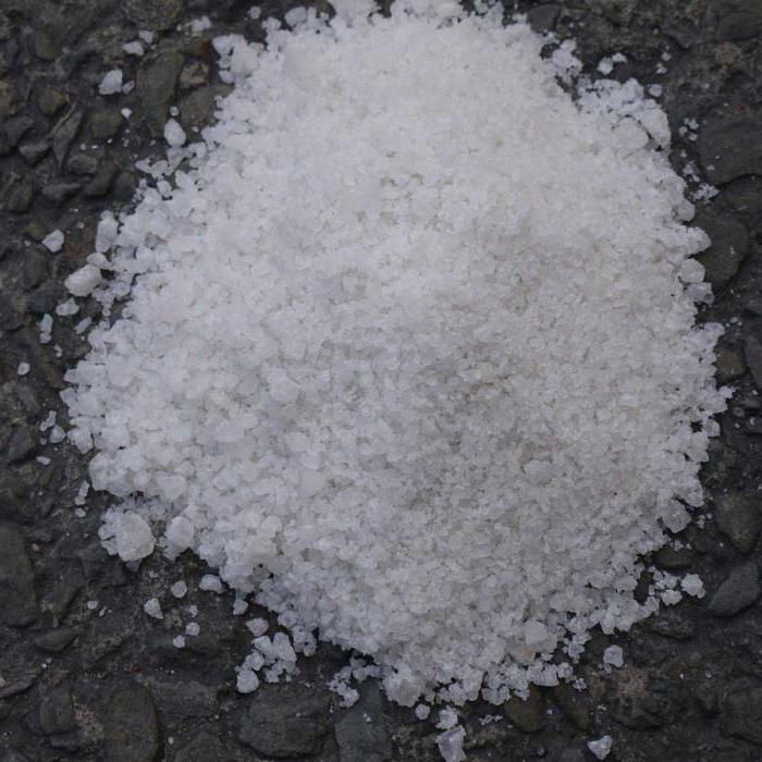
Salt deposits of Perm
It turns out that one of the world leaders in salt reserves is the Perm region. Minerals of the Verkhnekamskoe deposit are represented by rock, potassium and potassium-magnesium salts. Within the radius of Berezniki and Solikamsk, salts are located in thick layers at a depth of up to 600 meters. The topmost layer is stone, which is also found as an intermediate strip. Behind it comes a layer of potassium-magnesium, and the hardest thing to get to is the potassium-stone layer. Jokingly, geologists call the deposit a “pie.”
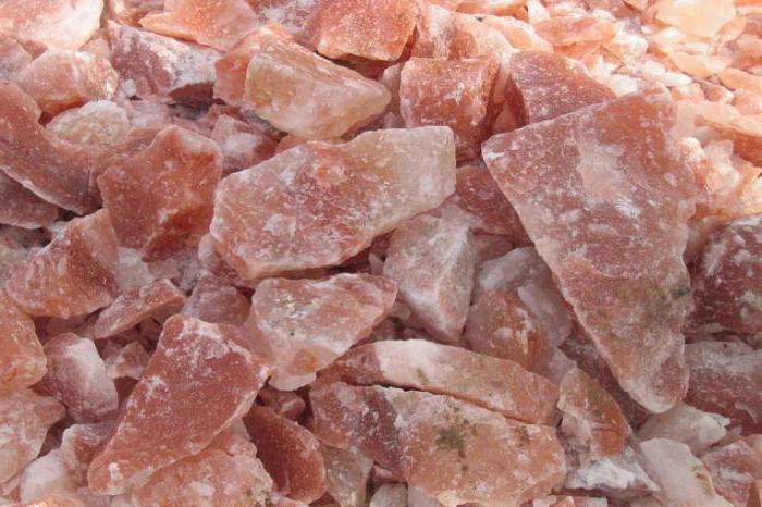
The Verkhnekamsk salt deposits were formed more than one million years ago. It turns out that there was once a sea here. Due to exposure to hot sun rays, sea water was heated and evaporated over a long period of time. The concentration of salt in the gradually decreasing amount of water increased, and it began to accumulate mainly at the bottom of small shallow bays. And so, when the sea disappeared completely, in its place began the formation of an underground storehouse of various salts, painted in many colors: from snow-white to bright red.
Rock salt resources
Rock salt often has a pink and yellow color, while the complete list of mineral resources of the Perm region also includes a colorless pure subtype of these reserves. Halite (as transparent salt is called) easily dissolves in water; it is what the population has been using for their domestic needs for several centuries in a row. The Upper Kama has places where groundwater comes close to the salt depths. This phenomenon became the reason for the emergence of natural salt springs.
The pioneers of salt making were the merchant couple Kalinnikovs, who arrived from Novgorod. Having become interested in the riches of the Perm land, they established salt mining near the Usolka and Borovitsa rivers, building several houses and equipping saltworks. Afterwards it will become known that the emergence of the small village of Sol Kamskaya around the main fishing grounds served as the basis for the emergence of the modern city of Solikamsk.
Development of salt making in the 15th-16th centuries
Basically, salt production involved pumping out brines and evaporating them. An important fact of that time is that table salt could not be bought so easily. It could be purchased at a price that not everyone could afford.
Soon the Kama region came into the possession of other owners, who received a royal permit from Ivan the Terrible. In the middle of the 16th century, the merchants Stroganovs, engaged in industry, became the owners of the lands. Since then, salt mining has reached a new level and glorified the entire Perm region. Minerals were sold within Russia and exported to neighboring countries. The economic development of this area brought significant income and made it possible to successfully develop the industry.
“Permyak – salty ears”
By that time, many ordinary workers were employed in the salt fields, who to this day retain the nickname known as “Permyak - salty ears.” They started calling them that for a reason. The fact is that work in the Stroganov fields was not considered easy, since it did not have the most pleasant consequences for the workers. Salt dust leaked through numerous bags of processed goods. This had the most negative impact on the health of people who constantly carry such a load: the shedding corroded the skin of the face, hands and ears, after which they turned red and inflamed.
In honor of the people who selflessly engaged in this work, a monument to Perm was erected in the central part of Perm. Verkhnekamsk salt remained for quite a long time the only salt shaker not only for all Russian residents, but also the main source for the development of the chemical industry and food technologies. However, with the discovery of more profitable deposits in the lakes of the Volga basin, the salt production industry significantly slowed down its turnover in the Perm region.
Production volumes
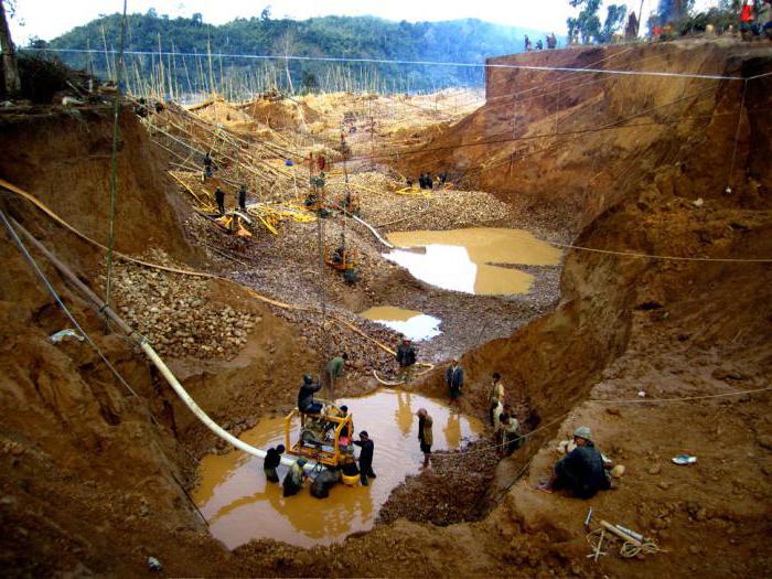
Mostly, gold remains in the region only in the form of placers, which are mined through panning. No large deposits of nuggets have yet been found in the 21st century. Over the past 10 years of work by miners, the volume of gold mined per year is 80-100 kilograms. Compared to other regions where mining takes place, these figures are quite low.
In total, work is underway on the reclamation of gold sand in 8 deposits in the region. In each place, gold grains of different sizes and weights are mined.
| Deposit name | Average size of gold chips in millimeters | Milligram of gold per 1 cubic meter meter |
| Cone | 0,6 | 0,8 |
| Cheryomukhov Cape | 0,2 | 25 |
| Pecherskoe | 0,1 | 55 |
| Troshkovskoe | 0,75 | 39 |
| Black | 0,3 | 90 |
| Mordvinskoe | 0,15 | 0,9 |
| Ivanovskoe | 0,75 | 80 |
| Korminskoe | 0,2 | 45 |
As can be seen from the table, the largest crumbs mined in the region are located at the mouths of rivers in the territories of the Troshkovskoye and Ivanovskoye deposits. These places are also leaders in rock density per 1 cubic meter of cultivated land. Of the 8 listed, only 2 of these deposits are being actively developed today.
Potassium-magnesium resources
Much later, near Solikamsk, Ryazantsev N.P. managed to discover deposits of potassium-magnesium salts. This important discovery for geologists happened while drilling a well, which was later named in honor of the discoverer’s wife Lyudmila. And a couple of decades later, in the vicinity of the Lyudmilinskaya workings, geologists found pink potassium salt, which has the scientific name sylvinite.
In the process of studying the found area, scientists found that the abundance of subsoil could provide the entire Perm region with glass and potash fertilizers for agricultural production. Minerals in the same area gave the developers another surprise just a year later: under a thick layer of rock salt there was a layer of salt deposits, which included magnesium.
From such dark red salts it was later possible to obtain a low-melting metal, which is used in shipbuilding and in the design of aircraft.
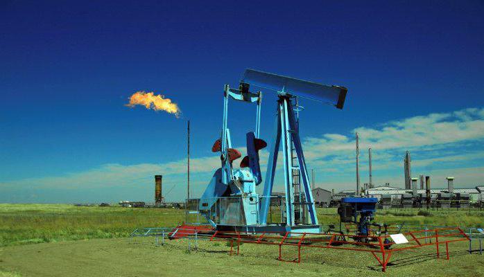
Discovery of oil fields
Considering the salt minerals of the Perm region (photos of some are presented above), it is worth mentioning the accidental discovery of an oil field. In order to identify the boundaries of the former sea expanses, a team of geologists, led by P.I. Preobrazhensky, in 1928, within the village of Verkhnechusovskie Gorodki, searched for additional, not yet explored salt reserves. No one could even imagine that they would find oil at the drilling site. Moreover, they wanted to stop the work due to the lack of salt production. Meanwhile, Preobrazhensky refused to liquidate the drilling rig, deciding to continue drilling and further deepening the well.
The chief geologist’s instincts didn’t let him down - from a depth of about 330 meters they pulled out rock filled with oil. As it turned out, the upper oil film was even deeper. A tower was installed at the site of the first well, which was respectfully nicknamed “grandmother”. The moment of the appearance of the first fountain breaking through the ground remained in people’s memory for a long time, reflected in literary works, essays, and memoirs.
The discovery of the next oil field of mineral resources in the Perm region occurred in 1934 in Krasnokamsk. This time, like the previous one, no one expected that they would again find something that was not exactly what they were looking for. Before stumbling upon oil, they planned to drill for an artesian spring in the city. Soon, geologists discovered several more deposits nearby, including Osinskoye, Chernushinskoye, Kuedinskoye, Ordinskoye and others.
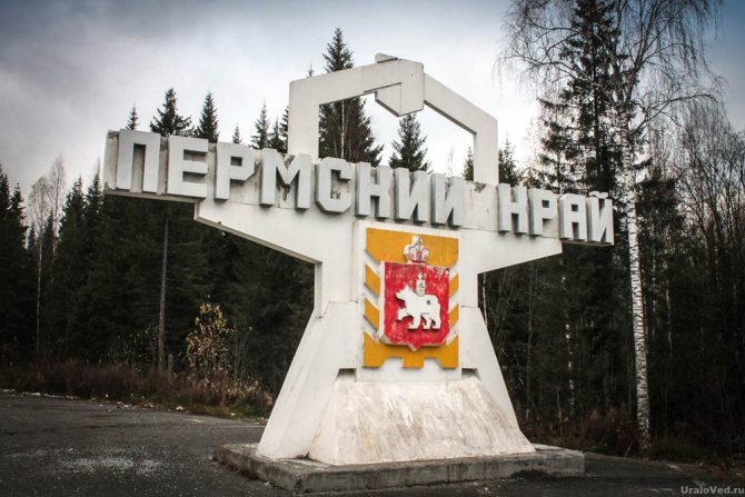
Features of the Perm region
The Perm region was formed on December 1, 2005 as a result of the merger of the Perm region and the Komi-Permyak Autonomous Okrug following the results of a referendum on December 7, 2003 (before that there was a smaller Perm region).
Perm region in numbers:
- Area 160,236 km2.
- Population 2,635,849 people (according to the 2010 census)
- Population density 16.4 people/km2.
- The share of the urban population is 74.2%.
- It is divided into 55 municipalities.
There are 22 cities in the Perm Territory: Perm, Berezniki, Tchaikovsky, Solikamsk, Kungur, Lysva, Krasnokamsk, Chusovoy, Dobryanka, Chernushka, Kudymkar, Gubakha, Vereshchagino, Osa, Kizel, Nytva, Krasnovishersk, Alexandrovsk, Ocher, Gornozavodsk, Gremyachinsk, Cherdyn .
Located in the east of the East European Plain and on the western slope of the Middle and Northern Urals. 99.8% of the area is located in Europe, 0.2% in Asia.
It borders on the south with the Republic of Bashkortostan, on the west – on the Udmurt Republic and the Kirov region, on the north – on the Komi Republic, on the east – on the Sverdlovsk region.
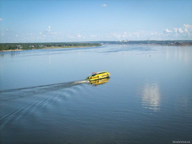
In terms of water resources, the Perm Territory is in first place in the Urals. There are about 30 thousand rivers and other water bodies. The main rivers: Kama, Chusovaya, Sylva, Vishera, Kolva, Yayva, Kosva, Kosa, Veslyana, Inva, Obva.
The Kama River is ahead of the Volga in terms of water content, and also ranks 7th in Europe in terms of length (1805 km) and 3rd in terms of water content. Within the region, during the construction of the state district power station, two huge reservoirs were created: Kamskoye and Votkinskoye.
More than 70% of the region’s territory is occupied by forests, and about 20% is farmland. The predominant tree species are spruce and fir. The proportion of deciduous tree species increases as you move south. The fauna is rich and diverse.
The climate is moderate continental. Winters are snowy and long, summers are moderately warm. The annual precipitation ranges from 350 mm in the south to 500 mm in the north and 700 mm in the mountains. The growing season is 145–165 days.
The annual budget of the Perm Territory for 2021 is 140 billion rubles.
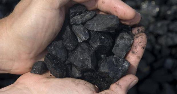
Coal basin in the Perm region
The mineral resources of the Perm region (photos and names of each can be found in specialized periodicals) also include coal in their list. Despite the fact that today the past reserves of coal are not enough to cover the production needs of the Kama region, it should not be forgotten that, for example, the Kizelovsky coal basin provided fuel to the main part of the Russian territory for more than two hundred years.
It is used at heating stations, industrial enterprises, metallurgical plants and for heating the population.
Geology
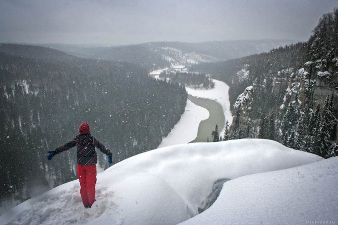
The territory of the Kama region is distinguished by great complexity and diversity. The western and central parts of the region are a gently undulating plain with altitudes of 200-400 m above sea level. The plain rises slightly to the east and south.
The highest mountains are in the northeast of the Perm region. The highest point is Mount Tulymsky Stone (1469 m).
In the northwest stretch the Northern Uvals, up to 270 m high, which serve as a watershed between the basins of the Kama and Vychegda rivers. In the west there is the Verkhnekamsk Upland with heights up to 335 m, from where the Kama River, the main river of the Perm region, originates.
In the south stretches the Tulvinskaya Upland (up to 446 m), which to the southwest gives way to the Buiskaya undulating plain. In the southeast is the northern end of the Ufa Plateau (its most elevated part is the Sylvensky Ridge, up to 403 m high).
Between the Northern Uvaly and the Verkhnekamsk Upland lies the Veslyanskaya Lowland (average heights 140-150 m). The lowest areas of the region are the valley of the Kama River and its tributaries. In the extreme southwest of the region, at the edge of the Kama River, the lowest point of the Perm region is located - 66 m.
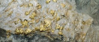
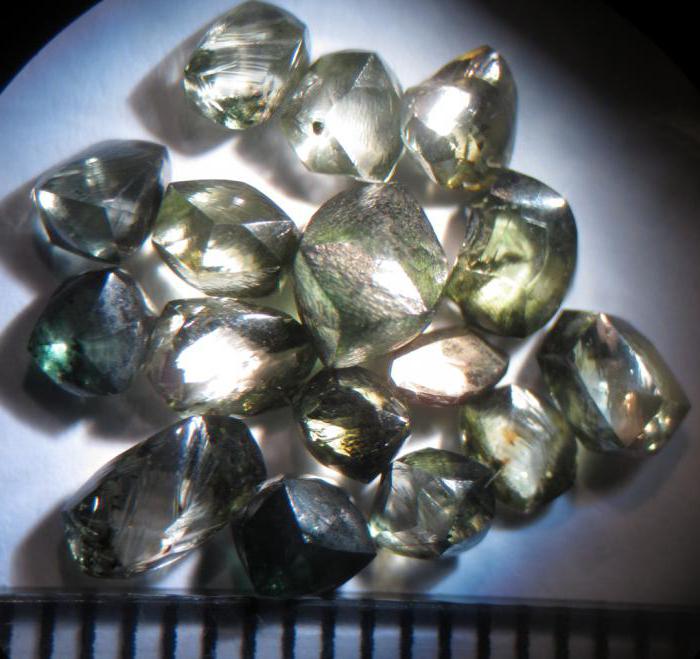
Mining of precious metals and stones
In some areas, precious diamonds are still being mined. They are found in rocks and rocky deposits of river banks. Mostly colorless stones are found in these places, but yellow and blue diamonds were often found. Diamonds are cut diamonds. These precious stones are particularly expensive. They are used not only by jewelers when creating their masterpieces. Diamonds are often involved in many complex technological processes. For example, you cannot do without them when drilling hard rocks, processing glass, metal and stones.
They say that the first diamond was found by a Perm serf boy of about fourteen, Pasha Popov. Subsequently, he was given a manumission as a thank you for the valuable find. In the vicinity adjacent to the Vishera River basin, gold has been mined for about a century. The most successful deposits are called Popovskaya Sopka and Chuvalskoye.
First major finds
For the first 70 years of operation, gold was mined in the form of placers, which were obtained by panning at river mouths and by working on mountain ridges that were rich in gold-bearing quartz veins. The volumes of production were constantly growing and the industry, without changing its course in production, used only methods that were available at the very beginning, when the deposits were discovered.
But a situation arose due to which the miners decided to reconsider their approaches to work. At the end of the 19th century, reports of nuggets found in the region began to arrive. At first these were small pieces of gold rock, weighing no more than 20 grams. All of them were found in the mountainous areas of the region near gorges and coastlines located near the rocky rocks of the mountains.
Later, after the decision was made to mine the rocks in these areas, prospectors discovered real gold giants. In 1890, nuggets weighing up to 500 grams began to fall into the hands of workers at gold mining enterprises.
Such finds significantly increased annual production overall. Until 1914, all enterprises in the region produced approximately 1000 tons of gold. Based on this, we can conclude that up to 50 tons of precious metal were mined per year. Production, starting from the first years, has increased almost 1000 times.
Other types of minerals
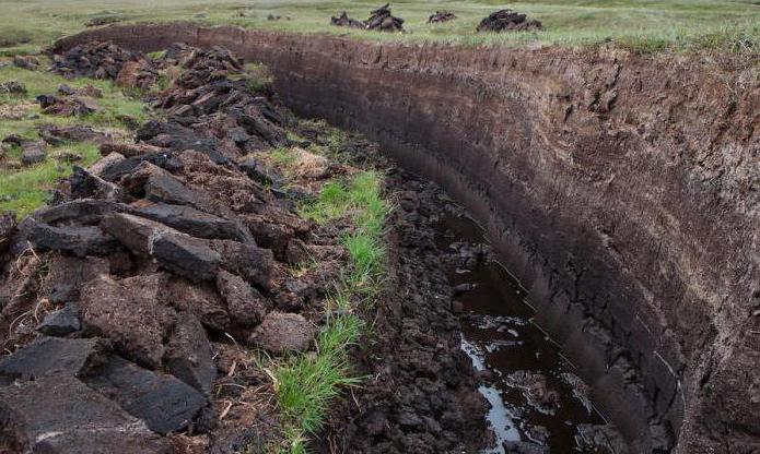
Some minerals in the Perm region are measured in huge reserves, which will last for more than one century. These include peat resources, which, according to preliminary geological calculations, amount to about several billion tons. Peat is especially valued not only as a type of fuel, but also as a natural fertilizer for plants.
It is also worth noting that clay, sand, limestone, and gypsum are the resources that the Perm region is rich in. Minerals of this spectrum are irreplaceable. They are widely used during construction work.
Source: fb.ru
nature